GeoSLAM ZEB Horizon Handheld Mobile Laser 3D Scanner | For Geophysical Survey & 3D Mapping
Product Overview
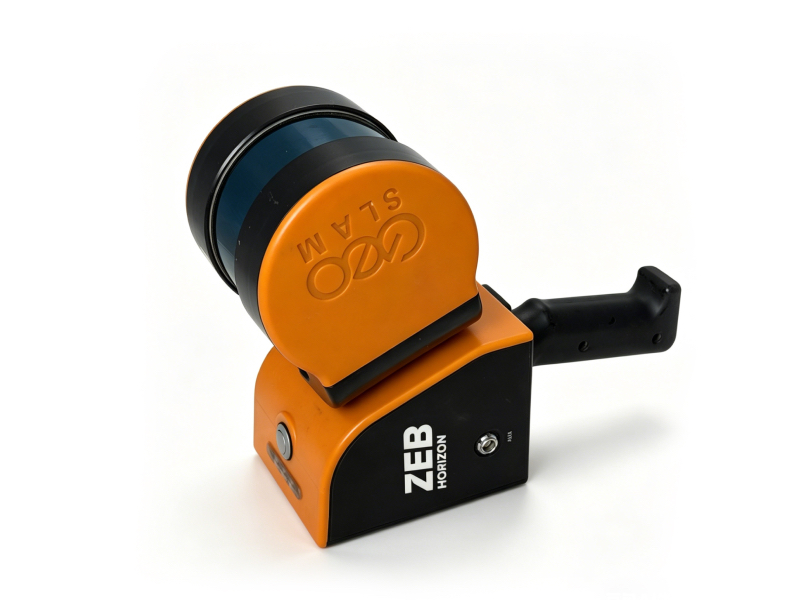
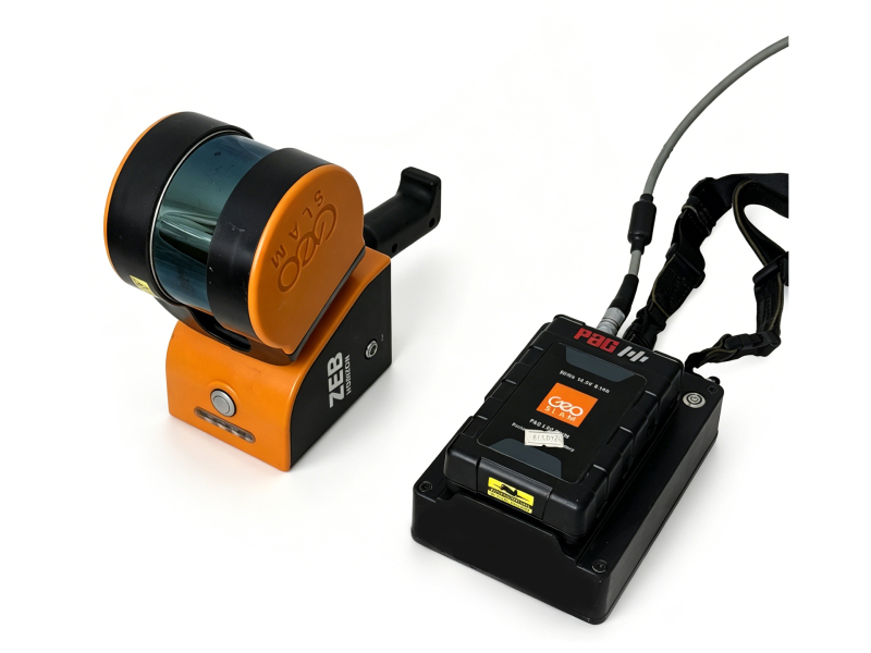
We are a professional cross-border supplier specializing in new and second-hand geophysical prospecting equipment. The GeoSLAM ZEB Horizon is a top-tier handheld mobile LiDAR scanner designed for efficient 3D data collection in complex environments. Built with advanced SLAM (Simultaneous Localization and Mapping) technology, it operates without GPS, making it ideal for underground, indoor, and remote outdoor surveys. With 1-3cm accuracy, 100m range, and a lightweight 1.3kg design, it’s the perfect tool for geophysical exploration, urban modeling, mine surveying, and second-hand equipment fleets.
Key Technical Parameters
| Parameter | Specification |
|---|---|
| Brand/Model | GeoSLAM ZEB Horizon |
| Scan Speed | 300,000 points/second |
| Maximum Range | 100m |
| Relative Accuracy | 1-3cm |
| Field of View | 270° (vertical) × 360° (horizontal) |
| Laser Channels | 16 lines |
| Weight (Handheld) | 1.3kg |
| Protection Grade | IP54 (dust & splash resistant) |
| Operating Time | 3+ hours (single battery) |
| Data Storage | 120GB internal storage |
| Operating Temp | 0°C to +50°C |
| Key Feature | GPS-free SLAM, multi-platform mounting (handheld/backpack/UAV/vehicle) |
 |
|
 |
Short Operation Manual
- Preparation: Fully charge the battery and insert it into the scanner. Ensure the SD card is properly installed for data storage.
- Power On: Press and hold the power button for 3 seconds. The LED indicator will turn green when the system is ready.
- Start Scanning: Press the scan button to begin data collection. Walk slowly and smoothly through the survey area, covering all target spaces.
- Data Management: Press the stop button to end scanning. Data is automatically saved to the internal storage. Transfer files via USB or Wi-Fi to GeoSLAM HUB software for processing.
- Post-Use: Power off the device, remove the battery, and store it in a dry, cool environment. Clean the scanner lens with a soft cloth after each use.