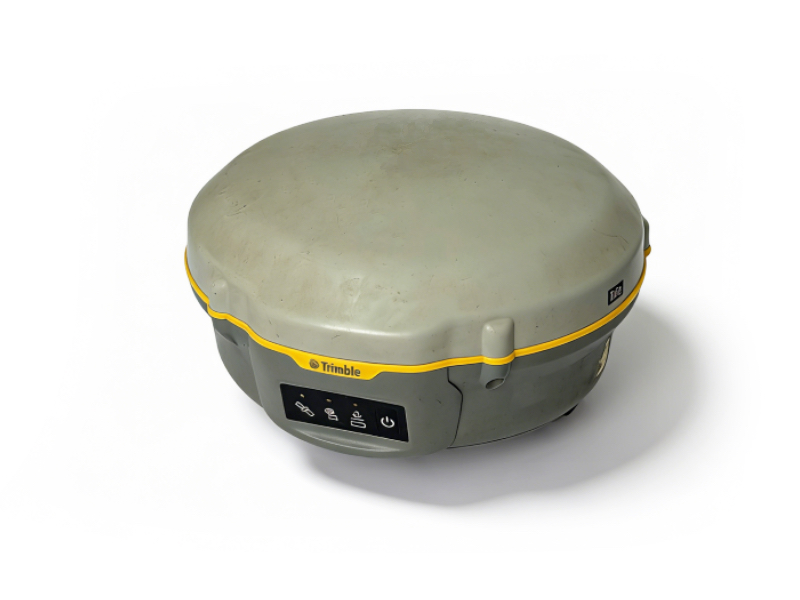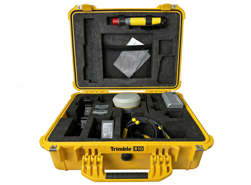
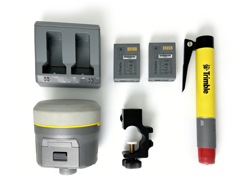
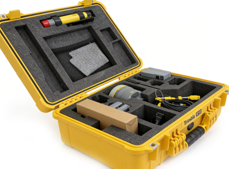
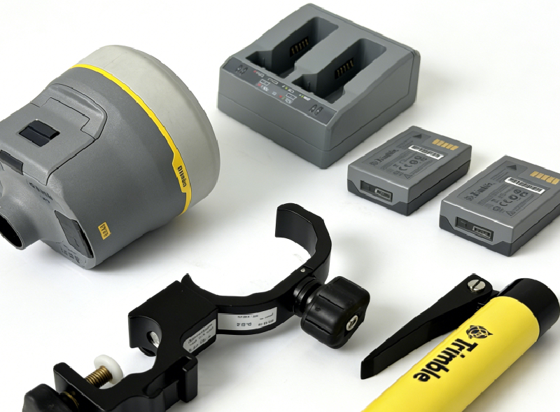
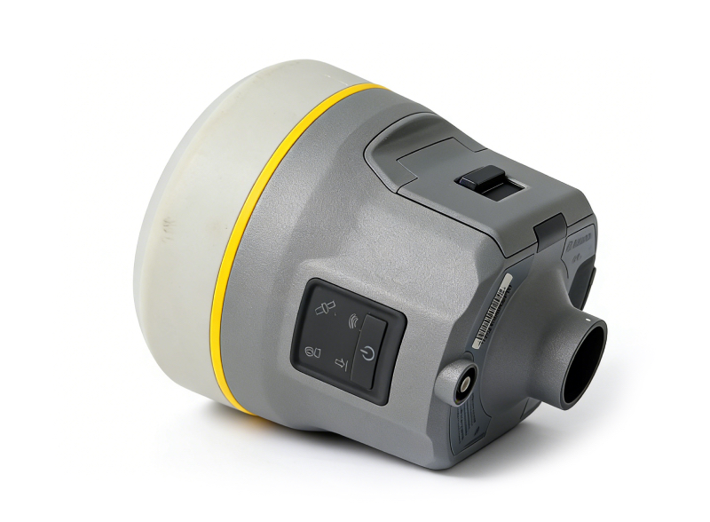
The Used Trimble R10 GPS is a professional high‑precision Trimble R10 GNSS RTK receiver designed for land surveying, civil engineering, mapping, construction, and geodetic data collection. As a reliable Trimble R10 High Accuracy Survey Receiver, it integrates advanced satellite tracking, anti‑interference technology, and a compact rugged build to deliver reliable positioning in dense urban, forested, and challenging worksites.
With 672 multi‑constellation tracking channels and Trimble HD‑GNSS / ProPoint positioning engine, it ensures fast satellite lock, strong signal penetration, and stable RTK performance. The all‑in‑one design includes integrated UHF radio, internal battery, and GNSS antenna for easy field deployment. It supports GPS, GLONASS, Galileo, BeiDou, and L‑Band correction services, meeting strict accuracy demands for European survey projects.
As a trusted used survey equipment supplier, we offer inspected, calibrated, fully functional Trimble R10 units with cost‑effective pricing, tested for compatibility and durability across construction, infrastructure, and GIS applications.
Measurement
• Trimble HD-GNSS technology enables faster and more timely measurement points in challenging environments
• Trimble SurePoint electronic tilt compensation improves survey efficiency and repeatability
• Trimble CenterPoint RTX satellite-delivered correction signals provide centimeter-level positioning accuracy worldwide
• Trimble xFill technology reduces downtime caused by interrupted radio signals
• Advanced Trimble Maxwell™ 6 custom survey GNSS chip with 440 channels
• Trimble 360 GNSS tracking provides future-proof investment
• Simultaneous satellite signal tracking:
–– GPS: L1C/A, L1C, L2C, L2E, L5
–– GLONASS: L1C/A, L1P, L2C/A, L2P, L3
–– SBAS: L1C/A, L5 (for L5-capable SBAS satellites)
–– Galileo: E1, E5a, E5b
–– BeiDou (COMPASS): B1, B2
• CenterPoint RTX, OmniSTAR HP, XP, G2, VBS positioning
• QZSS, WAAS, EGNOS, GAGAN
• Positioning rates: 1 Hz, 2 Hz, 5 Hz, 10 Hz, and 20 Hz
Positioning Specifications¹
Code Differential GNSS Positioning
Vertical: 0.50 m + 1 ppm RMS
SBAS Differential Positioning Accuracy²
Static GNSS Survey
Vertical: 3.5 mm + 0.4 ppm RMS
Static & Rapid Static
Vertical: 5 mm + 0.5 ppm RMS
Real-Time Kinematic (RTK) Survey
Single baseline < 30 km
Horizontal: 8 mm + 1 ppm RMS
Vertical: 15 mm + 1 ppm RMS
Network RTK³
Vertical: 15 mm + 0.5 ppm RMS
RTK Initialization Time (to specified accuracy)⁴
Trimble CenterPoint RTX
Vertical: 9 cm
RTX Convergence Time to Specified Accuracy¹²
RTX QuickStart Convergence Time to Specified Accuracy¹²
Trimble xFill⁵
Horizontal: RTK⁶ + 10 mm/min RMS
Vertical: RTK⁶ + 20 mm/min RMS
Hardware
Physical Specifications
Dimensions (W × H): 11.9 cm × 13.6 cm
Weight: 1.12 kg (with internal battery, internal radio, and UHF antenna)
3.57 kg (including above, plus pole, controller, and mount)
Environmental Specifications⁷
Operating temperature: –40°C to +65°C
Ingress protection: IP67 dustproof, temporary immersion to 1 meter underwater
Shock and vibration: Tested to the following environmental standards:
Shock resistance: Non-operating: Survives 2 m drop from pole onto concrete.
Operating: Withstands 40G 10 ms half-sine shock test
Vibration resistance: MIL-STD-810F, FIG. 514.5C-1
Electrical
• Power input: 11 to 24 V DC external power, overvoltage protection on Port 1 and Port 2 (LEMO 7-pin)
• Rechargeable and field-swappable 7.4V–3.7Ah smart lithium-ion battery with LED status indicator
• Power consumption in RTK rover mode with internal radio⁸: 5.1W
• Internal battery operating time⁹:
–– 450 MHz receive only: 5.5 hours
–– 450 MHz receive/transmit (0.5W): 4.5 hours
–– 450 MHz receive/transmit (2.0W): 3.7 hours
–– Cellular reception: 5.0 hours
Communication & Data Storage
• Serial port: 3-wire serial (LEMO 7-pin)
• USB v2.0: Supports data download and high-speed communication
• Radio modem: Fully integrated, hermetically sealed 450 MHz wideband receiver/transmitter with frequency range 410 MHz to 470 MHz:
–– Transmit power: 2 W
–– Range: Typical 3–5 km / up to 10 km optimal¹⁰
• Fully integrated, hermetically sealed 2.4 GHz communication port (Bluetooth®)¹¹
• Wi-Fi: 802.11 b/g, access point and client mode, WPA/WPA2/WEP64/WEP128 encryption
• External correction devices supported via serial, USB, Ethernet, and Bluetooth ports
• Data storage: 4GB internal memory, stores over 3 years of raw observation data (approx. 1.4MB/day) based on 14 satellites logged every 15 seconds
• CMR+, CMRx, RTCM2.1, RTCM2.3, RTCM3.0, RTCM3.1 input and output
• NMEA output, GSOF, RT17, and RT27 output
WebUI
• Simple configuration, operation, status monitoring, and data transfer
• Accessible via Wi-Fi, serial, USB, and Bluetooth