Introduction
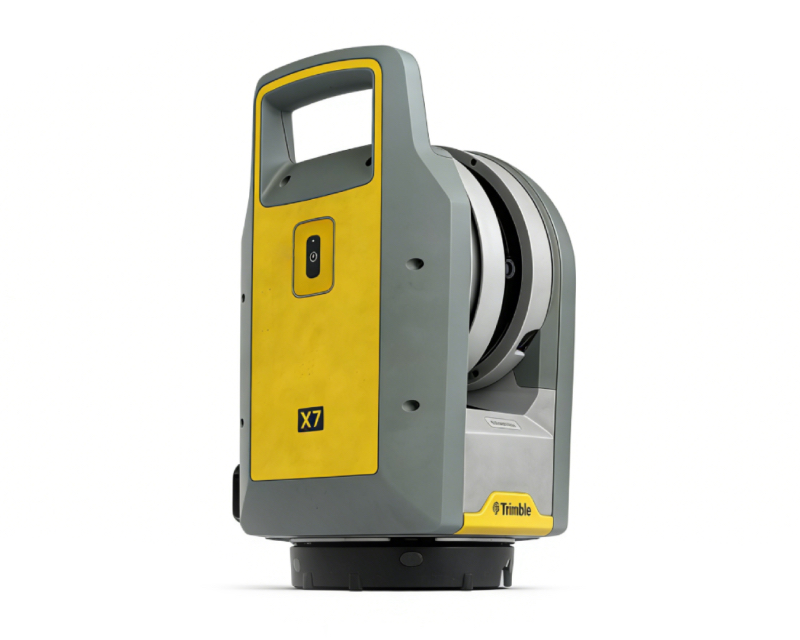
As a leading supplier of certified pre-owned surveying equipment, we specialize in providing high-quality, cost-effective Trimble X7 3D laser scanners to businesses across Europe, North America, and global markets. The Trimble X7 represents the pinnacle of high-precision 3D scanning technology, originally designed for professional surveying, construction, BIM integration, and industrial inspection. Our pre-owned units undergo rigorous quality control by certified technicians, ensuring they deliver the same exceptional performance and reliability as new models—at a fraction of the cost. Whether you’re a small surveying firm, a large construction contractor, or an industrial facility managing infrastructure projects, our used Trimble X7 scanners offer unbeatable value without compromising accuracy or functionality.
 |
Key Features & Technical Advantages of the Trimble X7
The Trimble X7 is engineered to streamline field workflows and deliver unmatched precision, making it a staple tool for modern surveying and construction projects. Our pre-owned units retain all its core innovations:
1. Unmatched Precision & Accuracy
Ranging Precision: < 2 mm at 30m with a maximum measurement range of 0.6m to 80m, supporting accurate data capture for both close-range and long-distance scanning tasks .
3D Point Accuracy: 2.4 mm @ 10m, 3.5 mm @ 20m, and 6.0 mm @ 40m, meeting the strictest standards for land surveying, BIM alignment, and industrial metrology.
Survey-Grade Self-Leveling: Automatically levels within ±10° with precision < 3”, eliminating manual leveling errors and reducing setup time.
2. Time-Saving Intelligent Technology
Trimble X-Drive Automatic Calibration: Self-calibrates distance and angle systems in 25 seconds without user intervention or targets, eliminating costly downtime for factory servicing 🔧.
Trimble Registration Assist: Automatically aligns and refines point clouds in the field using integrated IMU tracking, enabling on-site validation of scan data before leaving the job site.
High-Speed Scanning: Up to 500 kHz scanning speed, with a fastest scan time of 1 minute 34 seconds (no imaging) or 2 minutes 34 seconds (with imaging), drastically boosting project efficiency.
3. Robust & Versatile Design
IP55 Environmental Rating: Dust-tight and water-resistant, suitable for use in harsh outdoor and industrial environments (-20°C to 50°C operating temperature) .
Compact & Portable: Weighs just 5.8 kg with a lightweight, ergonomic handle design for easy transportation and one-person operation.
Integrated Imaging: 3 co-aligned 10MP HDR cameras capture 316MP high-resolution images, delivering colorized point clouds for detailed documentation and visualization.
4. Seamless Software Integration
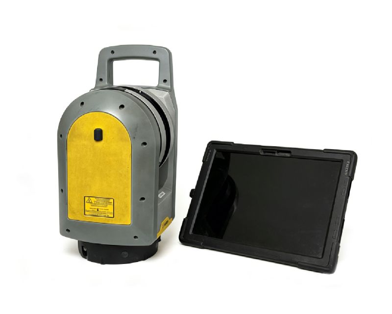
Trimble Perspective Software: Intuitive field control, data management, and validation workflows for seamless operation via Wi-Fi or USB connection to Windows tablets (e.g., Trimble T10).
Universal Data Compatibility: Exports to industry-standard formats (E57, LAS, PTX, TDX) for integration with Trimble Business Center, RealWorks, and third-party CAD/BIM software.
|
Why Choose Our Pre-Owned Trimble X7 Scanners?When investing in used surveying equipment, quality and reliability are non-negotiable. We stand behind our products with: – Certified Quality Control Each unit is inspected, tested, and calibrated by Trimble-certified technicians to meet original manufacturer specifications. We provide a detailed calibration certificate and functional test report with every sale, ensuring full transparency. – Cost-Effective Alternative – Global Export Support As a specialized export supplier, we offer tailored shipping solutions for clients worldwide: |
The versatility of the Trimble X7 makes it indispensable across multiple industries:
Building Construction & BIM: As-built documentation, floor flatness verification, and scan-to-BIM alignment for residential, commercial, and infrastructure projects.
Industrial Survey & Asset Management: Tank calibration, pipeline mapping, and structural integrity inspection for oil, gas, and manufacturing facilities.
Civil Engineering & Infrastructure: Road intersection surveys, topographic mapping, and bridge/roadway deformation analysis.
Forensics & Heritage Documentation: High-precision scanning of crime scenes, historical sites, and cultural heritage structures for archival and analysis purposes.
Utilities & Energy: Underground utility mapping, power line inspection, and solar farm layout verification.